Project information is subject to change. Your leader will reach out to you with an email after registration. Reach out to admin@wmhcta.org or info@wmhcta.org if you have questions.
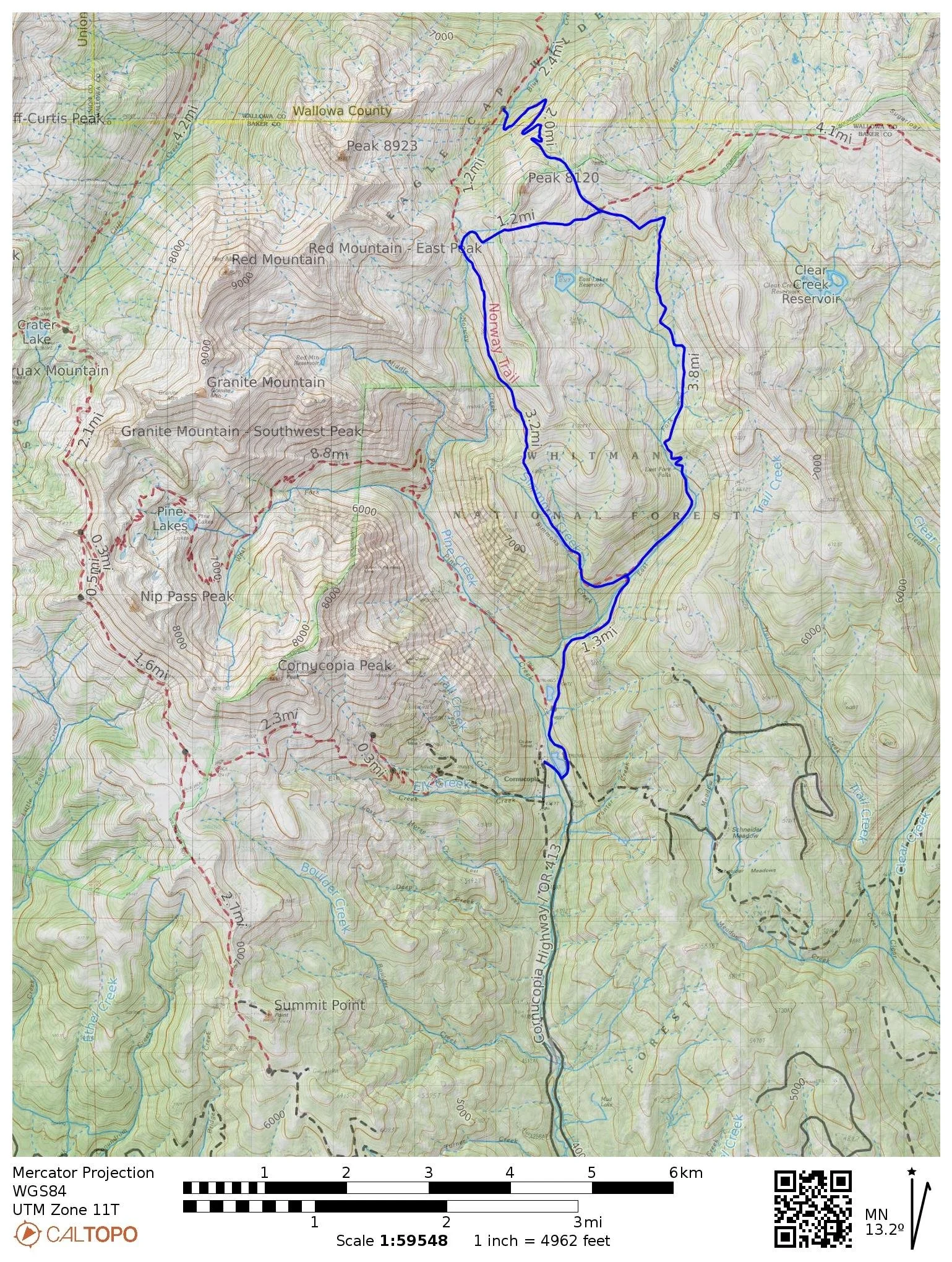
Trails: Blue Creek/East Fork Trail #1865, #1887, Norway Creek #1896
Trail Map: Blue Creek Trail Project(If QR code has expired, please download .pdf)
Itinerary: Meet 9:00am PDT on Thursday, August 15 at Cornucopia Trailhead. Trip entails 4-days of backpacking and trail work, with 3-nights of backcountry camping. Work is predominately log-out and swamping. The loop is approximately 11 miles, with an added trail segment of 2-miles down to Blue Creek itself.
Directions: USFS Cornucopia Trailhead
Driving Directions from Baker City Oregon/I-84: Take Exit 302 and head East on Oregon Highway 86 toward Hells Canyon/Richland Oregon for approximately 50 miles.
Bear left onto Highway 12 at the Welcome to Halfway sign. Continue for approximately 6.9 miles. (You will go through the town of Halfway where the road will become South Main, North Main, and then the Halfway/Cornucopia Highway 413.)
Once you have passed what is called Carson (just a small sign along the road) you will come to a fork in the road; take the dirt road to the left which is still the Halfway/Cornucopia Highway 413 for approximately 5 miles until you reach Cornucopia. This road is narrow with pull outs.
Once at Cornucopia you will need to take a right to go toward the Cornucopia Lodge. (look for the lodge sign at the rail fence) Once you have made this right there will be signs on trees provided by the Cornucopia Lodge on where you can park to access the trails in the area.
***Please remember you are on private property most all of the way to Cornucopia as well as once you get to Cornucopia. Please be respectful of the land.***
Bring your own food and ability to filter water. Trip is eligible for camping per diem.
Gear Packing List: High summer-hot conditions with periods of intense sun exposure and variable weather.
Crew Leader: Mike Beaty
Difficulty Rating: Moderate-Strenuous
You should have experience outdoors and be in good hiking condition with broken-in and tested gear. This is a remote backcountry project, so injuries such as sprains and blisters or even extreme fatigue from not being properly conditioned can quickly become a big safety issue.
Hike: 4/5 Moderate-Strenuous: Backpacking and tool carry.
Project Work: 3/5 Moderate-Strenuous: -- Mostly logout with some brushing.