Project information is subject to change. Your leader will reach out to you with an email after registration. Reach out to admin@wmhcta.org or info@wmhcta.org if you have questions.
Trails: Lackey’s Hole Trail #1942, Dobbin Trail #1913, Crib Point Trail #1909
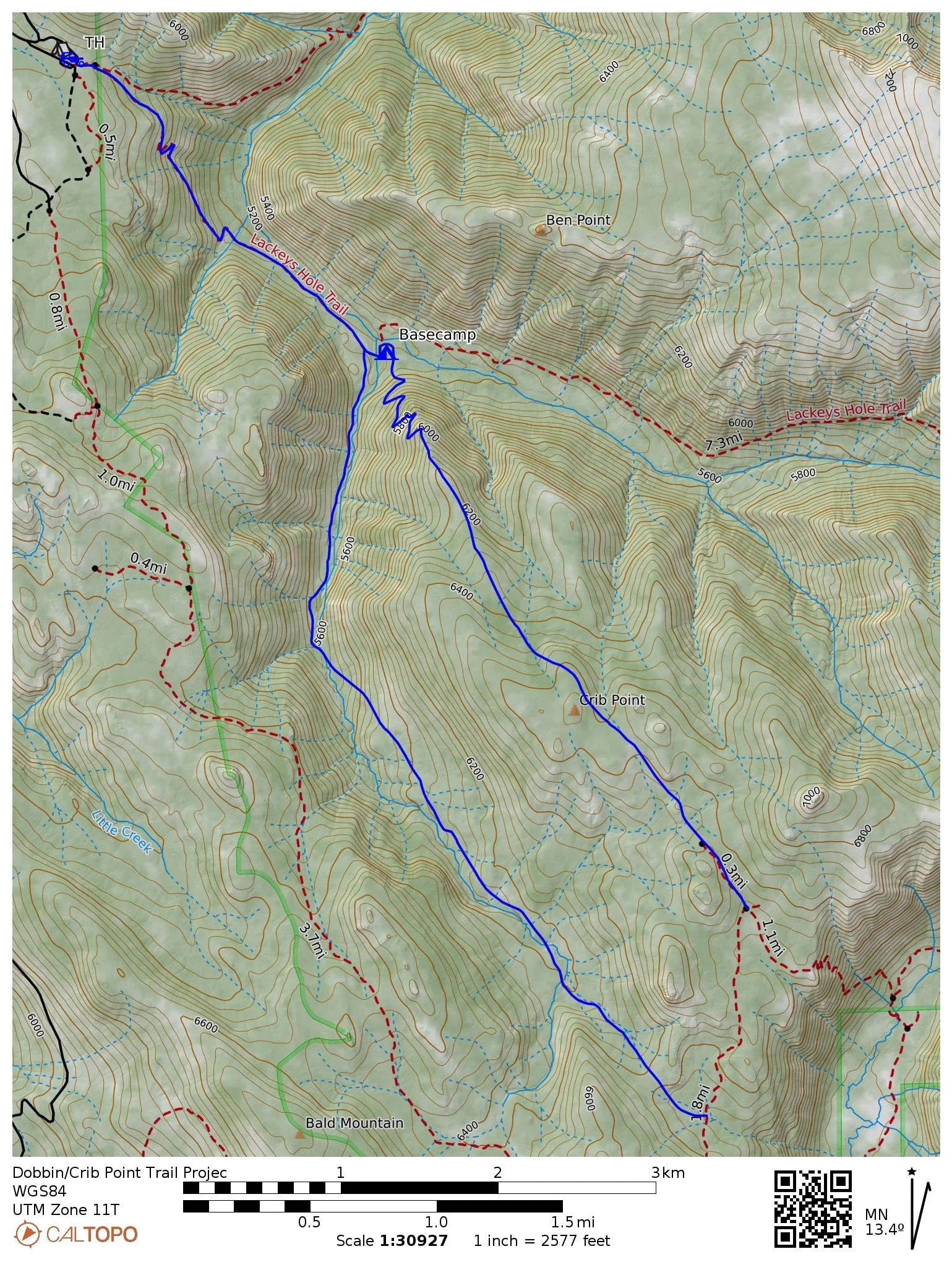
Project Trail Map: Dobbin/Crib Point Trail Project
Itinerary: This trip will start at the Moss Springs Trailhead. We will hike 2 miles down Lackey’s Hole trail to the junction with the Crib Point Trail, where we will establish a base camp. From there, we will work to clear trees and brush from both the Dobbin and Crib Point Trails.
Directions: From La Grande, Oregon travel northeast on State Highway 82 for about 2 miles to Island City; In Island City continue straight onto State Highway 237 (Cove Highway) and go 13 miles to Cove, Oregon; In Cove turn right on the Union Cove highway and go 1/2 block; Turn left on Hill Street and follow it to 2nd Street; Continue on 2nd Street which turns into Mill Creek Road; Follow Mill Creek Road which turns into Forest Road 6220; Follow Forest Road 6220 for about 8 miles to the campground and trailhead.
**Advisory - the last six miles of Forest Road 6220 is a steep, gravel surface, narrow road.
Bring your own food and the ability to filter water.
Gear Packing List: Early summer-hot conditions with periods of intense sun exposure and variable weather.
Crew Leader: Mike Hansen
Difficulty Rating: Moderate-Strenuous
You should have experience outdoors and be in good hiking condition with broken-in and tested gear. This is a remote backcountry project, so injuries such as sprains and blisters or even extreme fatigue from not being properly conditioned can quickly become a big safety issue.
Hike: 4/5 Difficult-Strenuous: Hiking is done over all types of terrain along a multi-day trip within 5-10 miles from a TH.
Project Work: 3/5 Moderate: Brushing, crosscut, chainsaw, and tread work.
Possible Hazards: Creek Crossings